Our map editor, free for everyone
This article was automatically translated.
In the post about the Year Zero Engine, Seb told you what we loved about Forbidden Lands: survival, time split into quarter-days, and hex-by-hex exploration. So we needed a map.
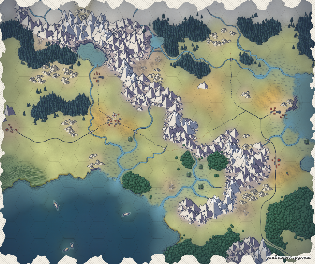
And that map had to be drawn. We tried several options. At first, we imported a background (a drawing, a map exported from Inkarnate, a map made by an illustrator we were working with) and only "annotated" it with the biome type of each hex. It was cool, but it's a lot of work to create a map. So I wanted to try procedural generation. And I'm pretty happy with the result. It's a first draft, we'll probably add more biomes, or other features. I was thinking of maybe adding cliffs and waterfalls, but that will probably come later.
And today, we're opening this editor to everyone: free, no account, no ads. It works for our game as well as yours, whether you play D&D, OSR or your homebrew system: in the end, it's an image.
Painting together
Anyone with the link draws on the same map, at the same time. You can do this for session zero: each player paints the region their character comes from, the GM ties it all together, and everyone discovers the neighbours they picked. But it might get a bit messy.
On the other hand, anyone with the link can also edit the map. To keep a map to yourself, don't share its address.
It's better in game
The open editor lets you create a map. In game, our app makes much fuller use of all this:
- The field of view depends on the altitude of the hex the party stands on, and each hex the gaze crosses reduces it more or less: a meadow lets the view through, a forest stops it. Climbing the hill before entering the valley reveals the whole rest of the adventure.
- Each biome has its own speed, on foot, on horseback and by boat.
- Survival depends on the terrain. Hunting, fishing, foraging, water, temperature, danger: the forest feeds you far better than the steppe, and the marsh is much more dangerous than the meadow.
- On the players' side, the map only shows what the party has seen. The rest is hidden by a fog of war that lifts as they explore, on everyone's screen, live.
How it works
We get asked this a lot, so let's be clear: there's no AI in there. The terrain generation is procedural. In short:
- Everything that looks random (the shape of a forest edge, the position of a tree) comes from a pseudo-random generator seeded with a seed and a key: that of the hex, edge or point involved.
- The map is first split into a pixel grid much finer than the hexes. Each pixel asks which hex it belongs to, but only after being slightly displaced by noise (two layers of value noise: this is domain warping). As a result, the borders between biomes wave instead of following the sides of the hexes. Each biome then becomes a blurred value field, whose 0.5 contour line is traced with the marching squares algorithm.
- Distance fields everywhere. A distance transform gives each pixel its distance to the edge of its region. This simple field is used for many things: the forest is dense at its heart and thins out at its edges, the ridge of a mountain range follows the maxima of this field (a kind of skeleton of the region), and the parallel lines outlining the coasts, as on old maps, are lines of equal distance to the shore, slightly distorted by noise.
- Rivers follow the edges of the hexes, which makes them a graph.
- Trees, peaks, tufts of grass: everything is placed with Poisson sampling (Bridson's algorithm), which guarantees a minimum distance between two elements without falling into an overly regular grid. Roads and rivers are first stamped into a separate layer, and each element checks that it doesn't land on them.
- Underneath it all, the biome colours blend into one another like washes, disturbed by noise, laid on a paper grain with a few stains and a slight vignette.